We’ve always loved southwest Colorado, but the family’s first exposure to the area came sans moi back in 1988 when Wendy, her dad, and the three kids made a 6-week trip, zig-zagging cross-country to Grand Tetons where I met up with them. I’m catching up with their experience only now, nearly thirty years later, checking off Fort Davis, Carlsbad Caverns, and White Sands. And now it’s southwest Colorado.
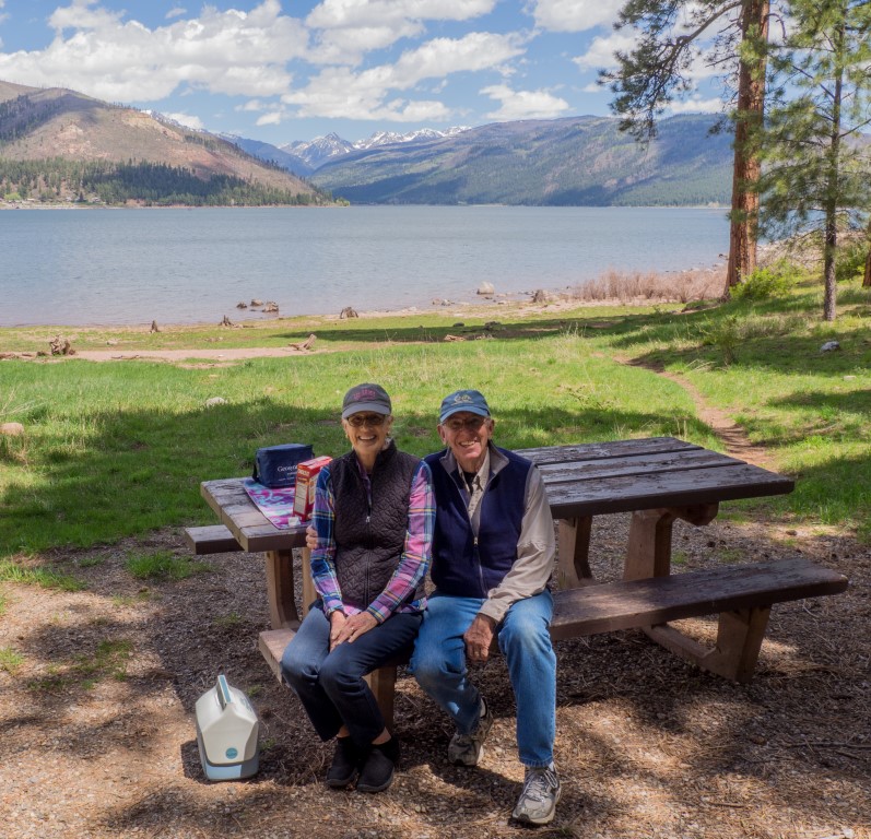
Their base of operations for the area was a reservoir 18 miles from Durango, Vallecito Lake. At 7800 feet, it’s the highest such lake in Colorado, and is situated in an unbelievably picturesque valley. Our mission: find the camp site where the family stayed 29 years ago. Success:
There are many stories attending the stay at Lake Vallecito (Jennifer coming down with something, the boys converting a log in the freezing cold water into a makeshift raft, Cliff celebrating his 10th birthday, Robert getting his finger stuck in a Coke can) (although consensus seems to be emerging that the finger-in-a-can event actually happened at Fort Davis), but the story that gets the most play involves Cliff standing motionless in the field, like the human equivalent of a Great Blue Heron, with his arm cocked and spring loaded, until bam! he snatched a field mouse out of the grass. Funny how in a beautiful place like this, every time one mentions Lake Vallecito, someone immediately chimes in with, “Isn’t that where Cliff caught the field mouse?”
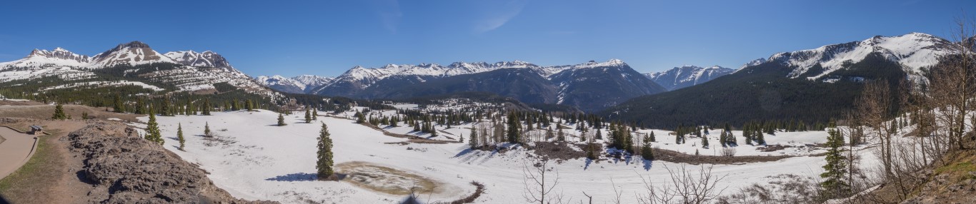
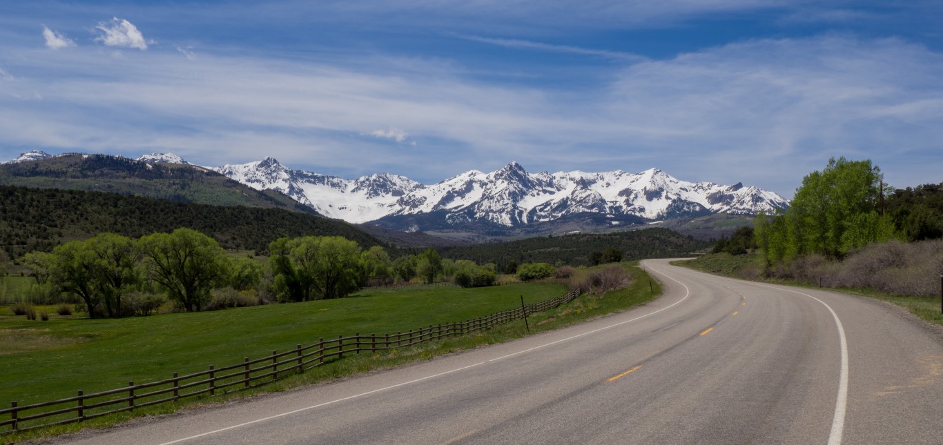
The next day, it was off to drive the San Juan Skyway, a 236-mile designated scenic drive that forms a loop around the San Juan mountains in southwestern Colorado. That range is the largest mountain range in Colorado and has 19 peaks above 13,000 feet. Even in mid-May, the upper portions of the drive were covered in snow.
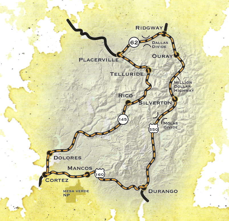
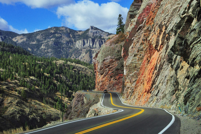
But the highlight/lowlight of the route, without a doubt, is the famous/infamous “million dollar highway,” a terrifying stretch of “road” between Silverton and Ouray, famous not only because it is narrow (barely wide enough for two cars) and twisty, but because it has no shoulders and no guardrails, and has a rock face crowding one side and a thousand-foot sheer cliff along the other. If that description doesn’t scare the bejeezus out of you, perhaps you should consider that the road figures prominently on the list of the world’s most dangerous roads: Dangerous Roads.
Hard to believe, but it was a great day. After seven hours on the road, though, we were ready for a rest.
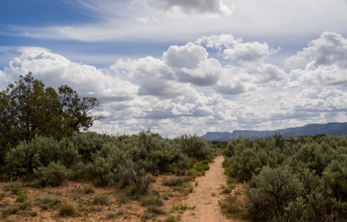
One other thing we did in the Four Corners area: We asked the clerk at the campground what was a fun thing to do locally and she suggested Hawkins Preserve. This seems to be a recurrent theme in our travels: small, locally funded nature preserves that are well done, completely enjoyable, and turn out to be surprising highlights of the trip. This preserve had a network of trails, maybe 4 or 5 miles total, with a wonderful picnic area in the middle.
Next stop: Arches and Canyonlands National Parks.