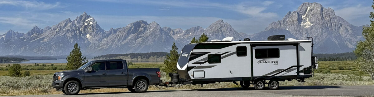
This stop didn’t start well… After arriving and setting up, we followed our standard routine of going to the visitor center, getting the maps and trail guides, and asking our usual question of the ranger: “We only have ‘x’ days here, what are the top things we should do?” Then, collecting the information we received, we decided to sit down over a cup of coffee and plan out the next three days. Glacier runs a shuttle between various areas of the park, so we thought it would be fun to take the shuttle to the Lake McDonald Lodge, seeing the beautiful mountains as we went, grab a chair in the lobby overlooking the lake, and make our plans.
Bad idea. First, I have no idea what I was thinking. I hate buses, especially diesel-powered, fume-belching, loud vehicles like the one that awaited us, made even worse by a what I assume is a disintegrating transmission that emitted an ear-piercing whine every time it was revved up. And then, the Lake McDonald Lodge is a L-O-N-G ways from the visitor center, and there’s nothing to see enroute. No mountains, no glaciers, not even decent views of the lake. And then, the Lake McDonald Lodge is definitely nothing to get excited about, certainly not on a par with the Jackson Lake Lodge or the Yellowstone Lodge, and there was no place to sit anyway. And finally, on the way back, the shuttle only ran in one direction, so we had to go way up the park to get to the turn-around point, where our 20-seat shuttle bus was boarded by 50 hot, sweaty hikers, giving it the all the ambiance of a jitney in Calcutta.
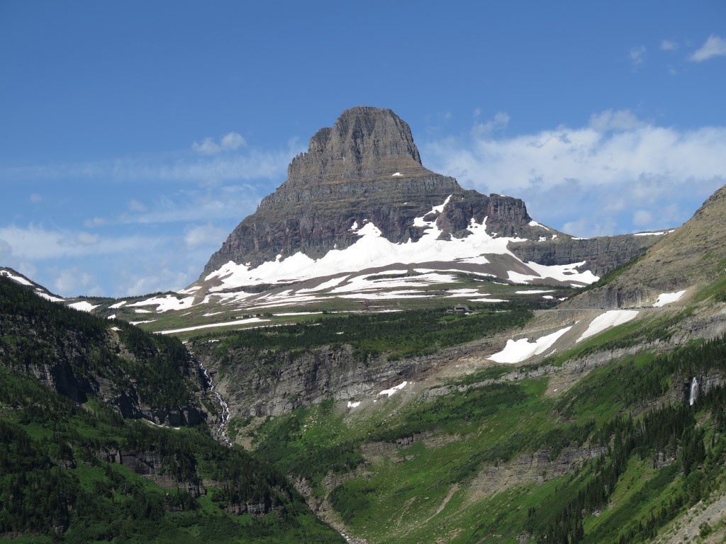
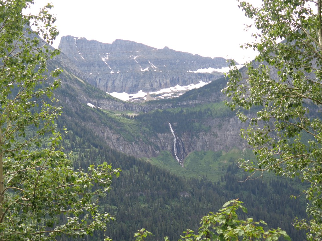
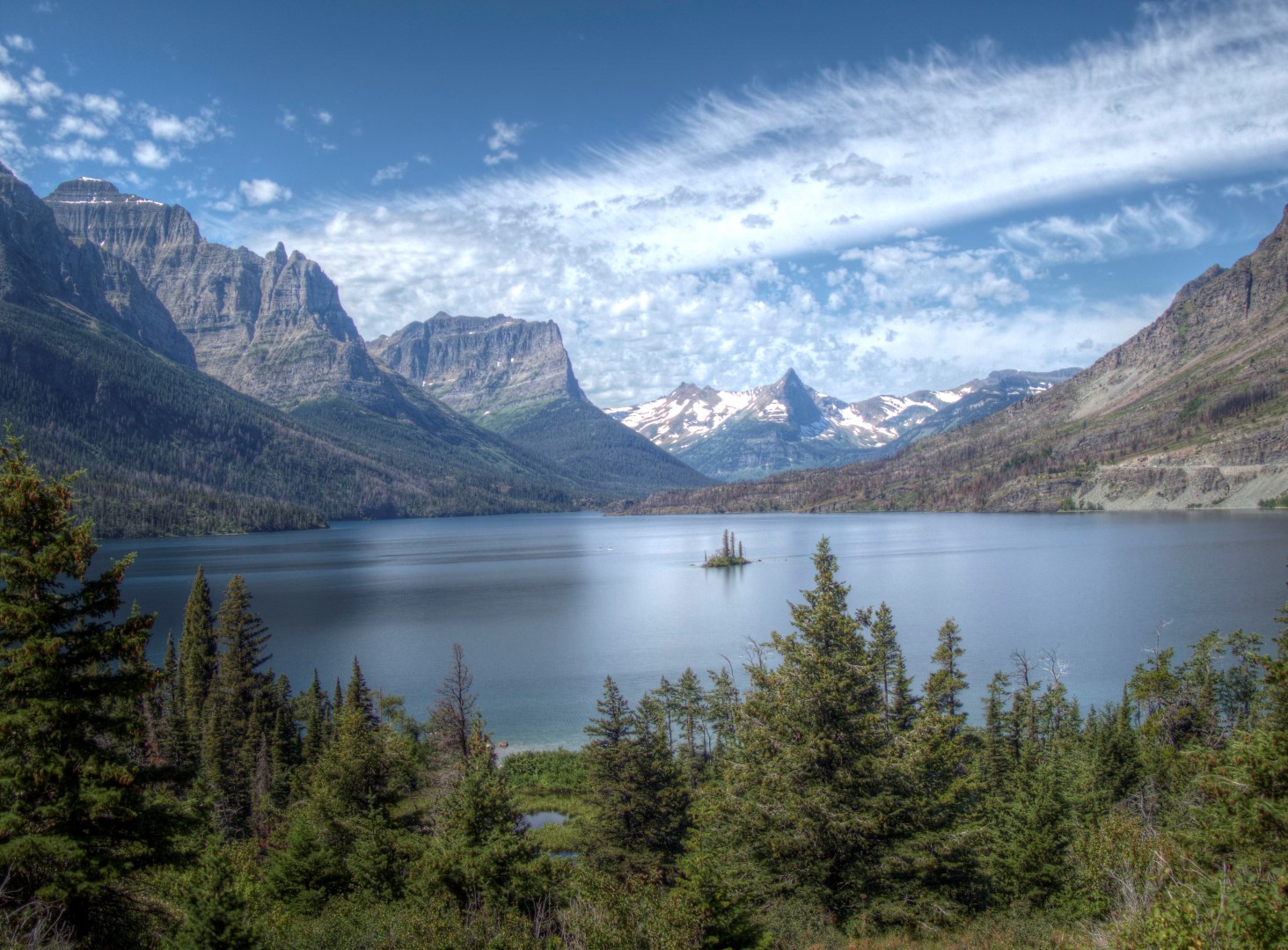
But, the next day, the sun came up, my disposition improved, and it was time to do the famous Going To The Sun Road. Words cannot describe that drive: 48 miles of an amazing engineering accomplishment routed through the most breathtaking scenery in America.
Until the road ends at St. Mary’s Lake:
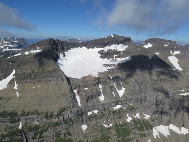
Here’s something that’ll make your brain hurt: The mountains that form the landscape, as can be seen in the photo above, are all sculpted sedimentary rocks. How could sedimentary rocks exist in what is an extension of the granite Rocky Mountains to the south? It turns out that about a billion-plus years ago, a huge sea (the “Belt Sea”) covered the area of present-day eastern Washington, northern Idaho, western Montana, and nearby areas in Canada. Over time, about 18,000 feet of sediment were deposited in the sea, which turned into the sedimentary rock of this area. (I can’t imagine 18,000 feet of sediment, but don’t hang up on that concept; things are about to get even weirder.) About 150 million years ago, the tectonic plates of North America started pushing against each other, forcing the uplift that created the Rocky Mountains. But while that was happening (according to geologists) a piece of the much older sedimentary rock from the Belt Sea, a piece about 300 miles long, 50 miles wide, and 20,000 feet thick, broke off and slid 50 miles eastward, so that it covered the younger rock of the Rocky Mountains rising underneath it. Excuse me? A sixty thousand cubic mile “piece of rock” “slid” to the east? It is that “piece of rock” that now forms the peaks of Glacier National Park. Then, about 2 million years ago, when about one-third of the planet was covered in ice up to 5000 feet thick, glaciers scoured the area creating the horns, aretes, and valleys we see now.
The glaciers that exist here now date from much more recently, only several thousand years. In 1910 when the park was founded, there were about 150 glaciers; today, there are only 25. As the planet continues to warm up since the end of the “Little Ice Age” in 1850, the expectation is that the glaciers will continue to retreat, perhaps disappearing entirely by the year 2030. [Note to family members: better make reservations for your trip here before it’s too late.]
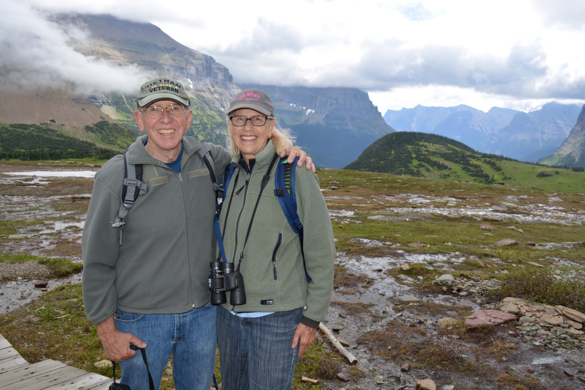
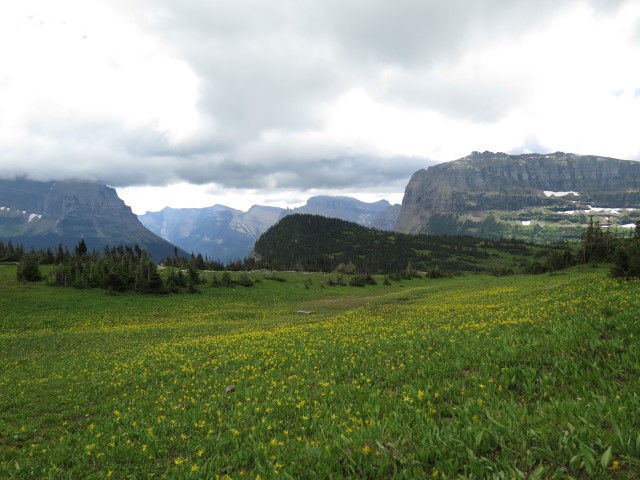
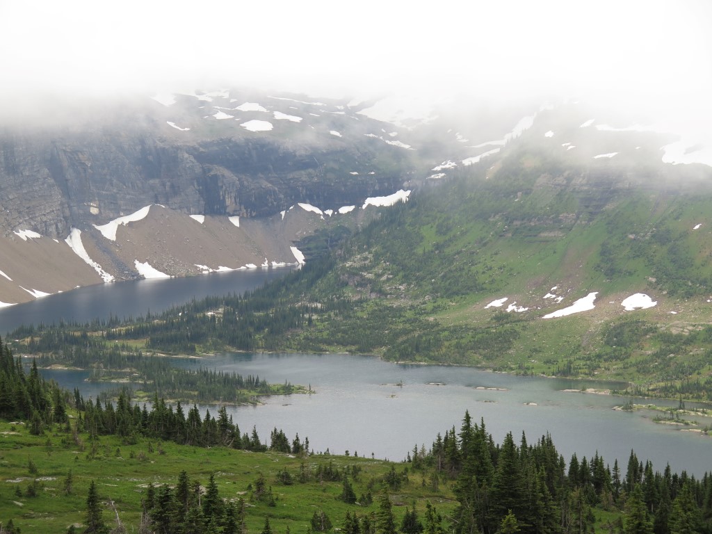
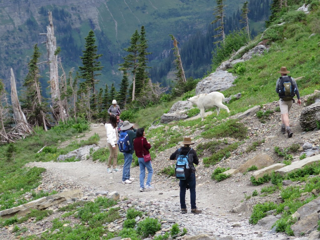
Next day, it was our favorite thing to do: hiking. The weather was cloudy and cool, but that’s not necessarily bad for a hike. So we were off to Logan Pass to do the hike to Hidden Lake.
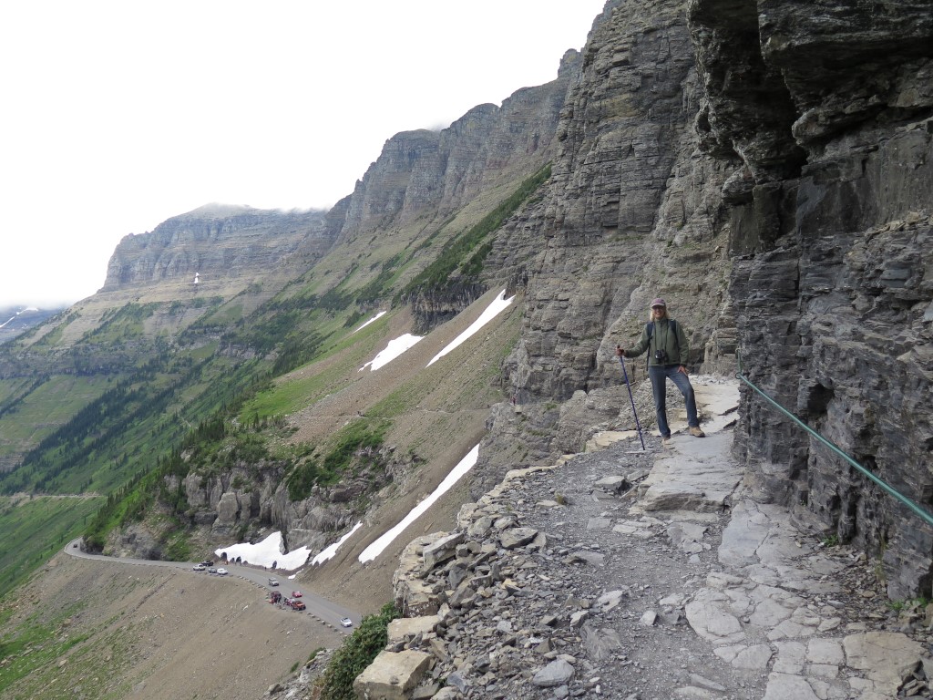
And then, off to the “Highline Trail,” a narrow (sometimes only 18-24″ wide), scree-covered pathway that clings to the sheer rock face. Definitely not a place for those afraid of heights.
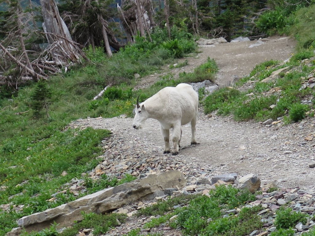
And finally, FINALLY, we got to see real, actual wildlife!
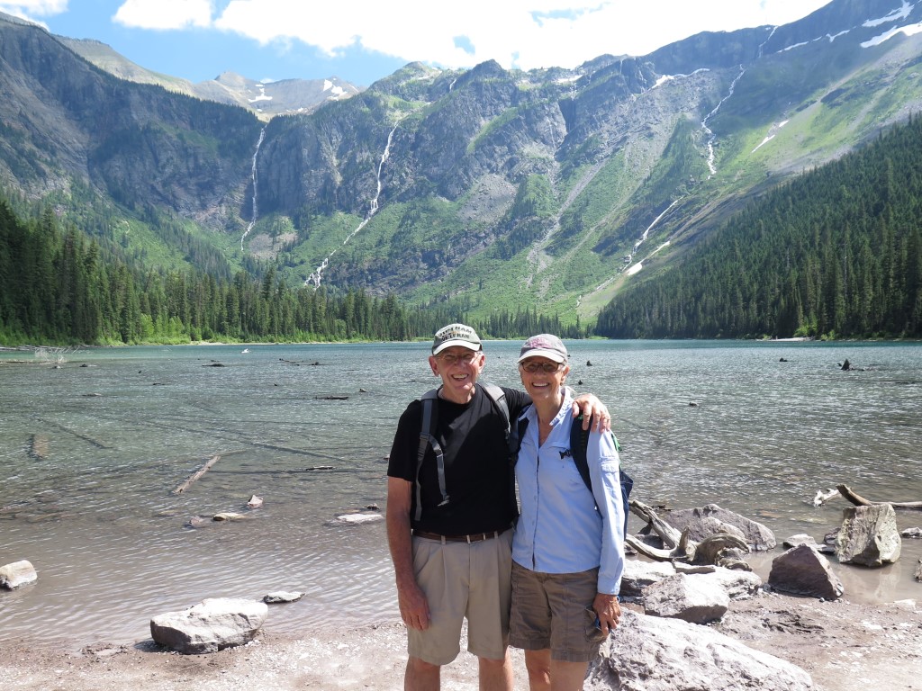
On Sunday afternoon, we did another fun hike, this one up to Avalanche Lake. Stunning.
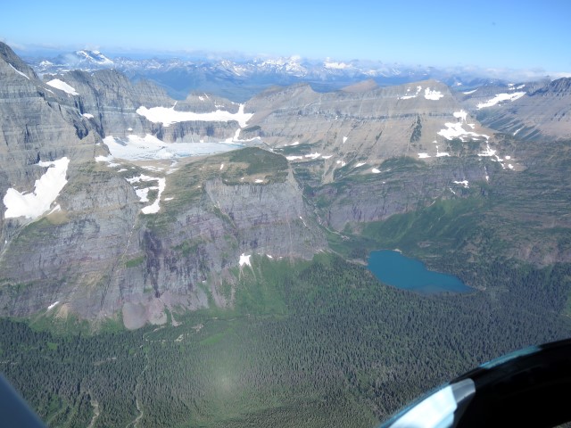
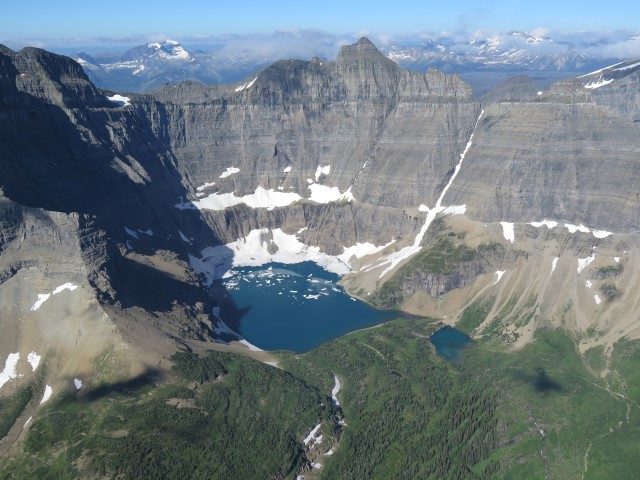
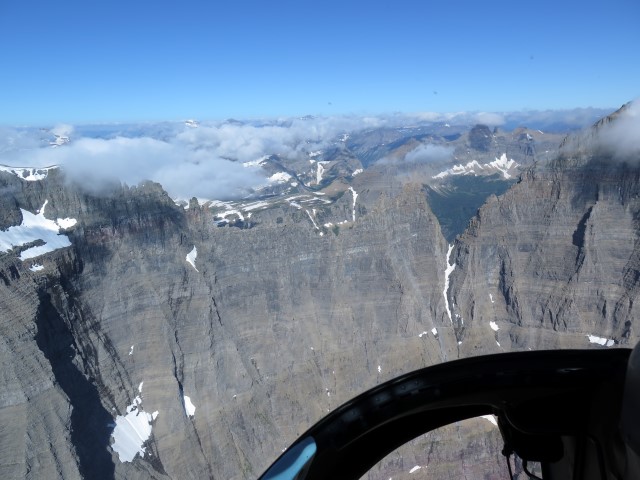
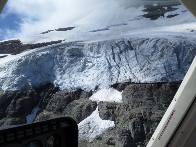
But before we did the afternoon hike, we faced a realization. Most of Glacier National Park is roadless and inaccessible. Only about 5% of the park is visible from a road. Of the 25 glaciers, only one is visible.
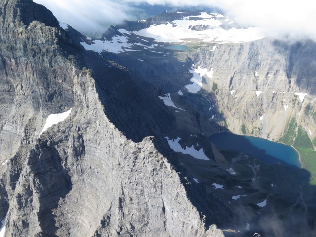
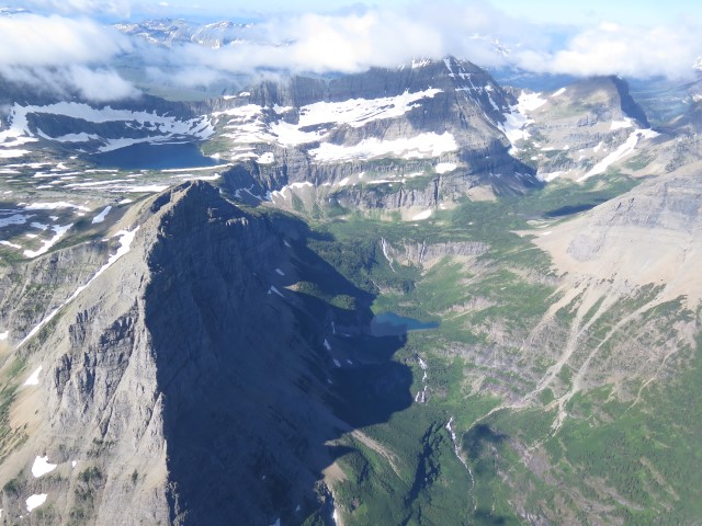
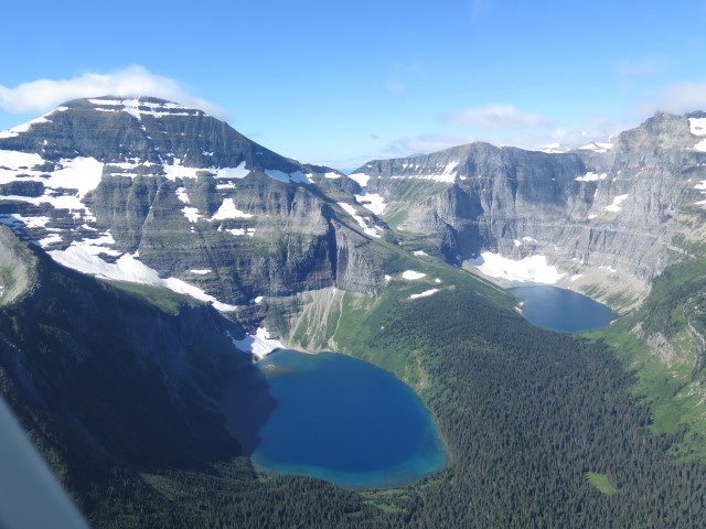
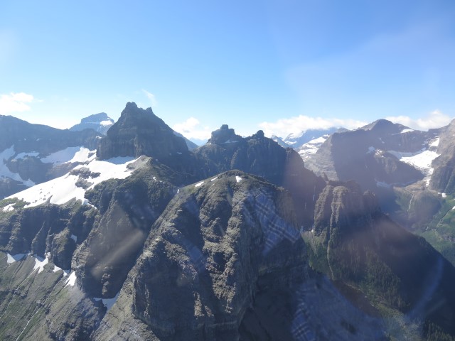
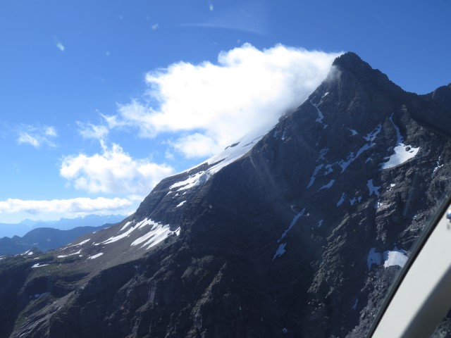
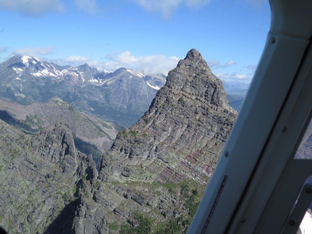
As a result, there’s really only one way to see to see the park:
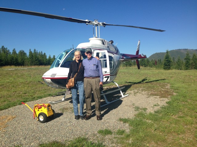
Seriously. OK, so we broke the budget. But it was worth every penny. The route took us down the western side of the park, up to Mt. Jackson and the Jackson Glacier, through Piegan Pass, up to the Many Glacier area, past Iceberg Lake and Margaret Lake, up to the Goat Haunt area, up to Waterton Lake [in case the FAA is reading this, we did not, repeat not, fly into Canadian airspace], down past the Rainbow Glacier, by Longfellow Peak, up the Avalanche Creek canyon, past Gunsight Mountain, across Lake McDonald, and then back. At least that’s what we can remember. The views were so stunning, and the narration to compelling, and I was snapping about a picture every two seconds, all of which means we can hardly remember everything we saw. Plus the weather was so perfect (no wind and zero-zippo-nada turbulence, even at the ridgelines) that at times we got so close to the glaciers that the pilot confessed he couldn’t get any closer without “making snowcones.”
So, here are a few of the pictures from that trip.
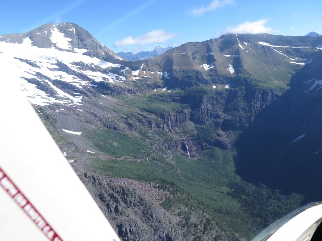
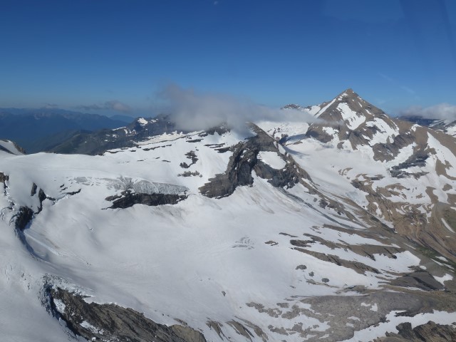
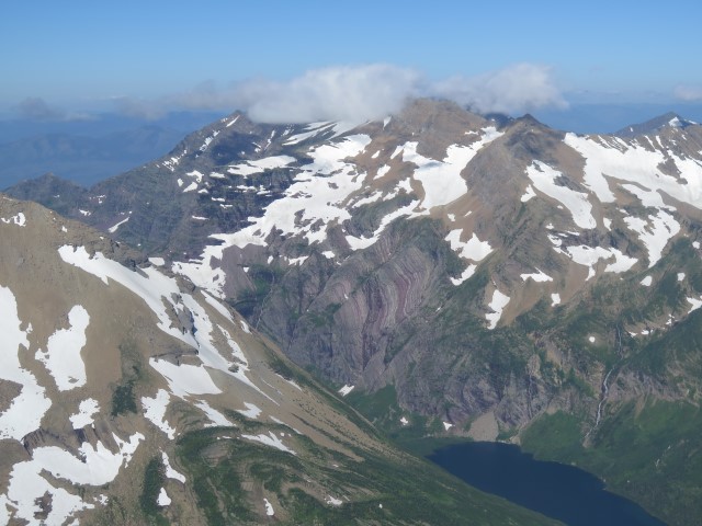
I know, I know. That’s a lot of scrolling. But trust me; there are lots more pictures where those came from. And if it looks like the pictures were taken from someone flying left seat, that’s right. I was. What a treat.
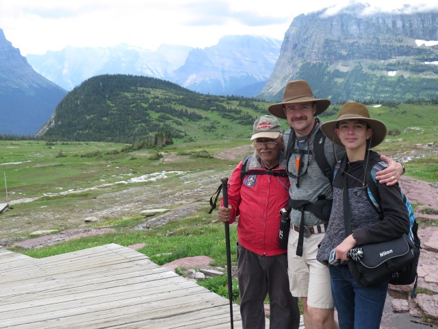
As an aside, we’ve previously noted the virtue of hiking and camping as a family activity. We usually think of that when we see young couples with gaggles with little rug-rats in tow. But this trip presented a particularly heart-warming variation on that theme. As we hiked up to the Hidden Lake overlook, we came across a family group from Puerto Rico. A father, who had been here years ago, not only brought his son here to experience the splendor of this place, but he brought his 77-year-old father along as well.
Finally, there are about 30 subscribers to this blog. As near as I can tell from reviewing the analytics, about ten people are following our travels, two readers can’t figure out how to work the unsubscribe function, and the rest are reading only the updates on the dogs. For the benefit of that last group, the dogs are fine. We’ll be heading home in a few days and there’s really no point now in having them put to sleep. We’ll reevaluate their status before we leave on the next trip.
We’re off to Cody, Wyoming, for a few days, then we’ll start the pedal-to-the-metal return trip.